highway2vec
Kacper Leśniara and Piotr Szymański
Representing OpenStreetMap microregions with respect to their road network characteristics
Link to repository
Link to paper
Goals
> Find representations (embeddings) of microregions with respect to their road network characteristics
> Define a typology of such regions
Data
OSM
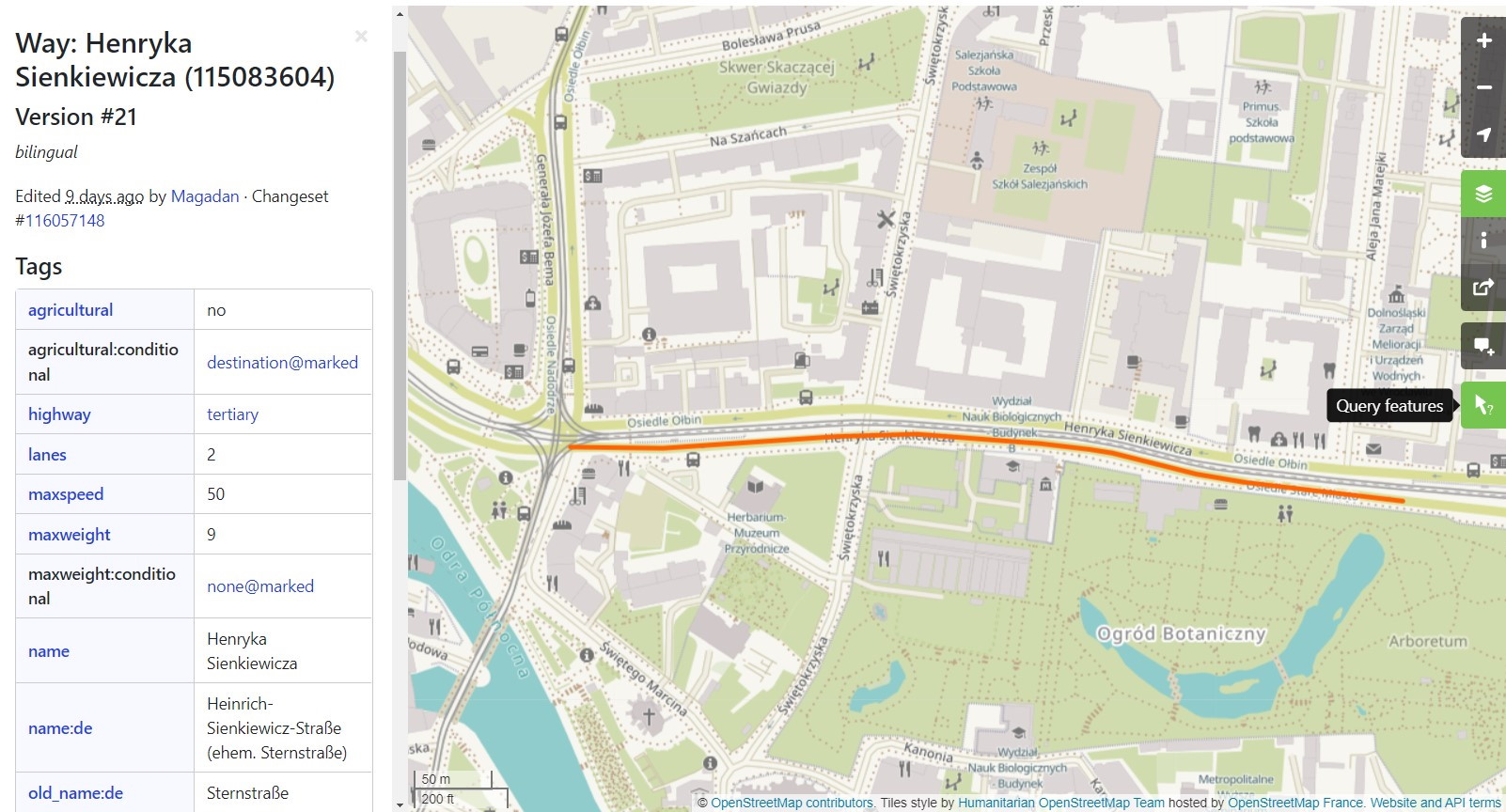
Road Network
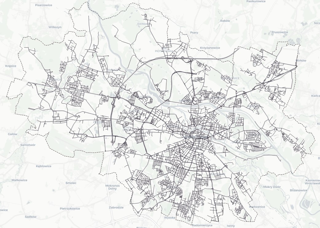
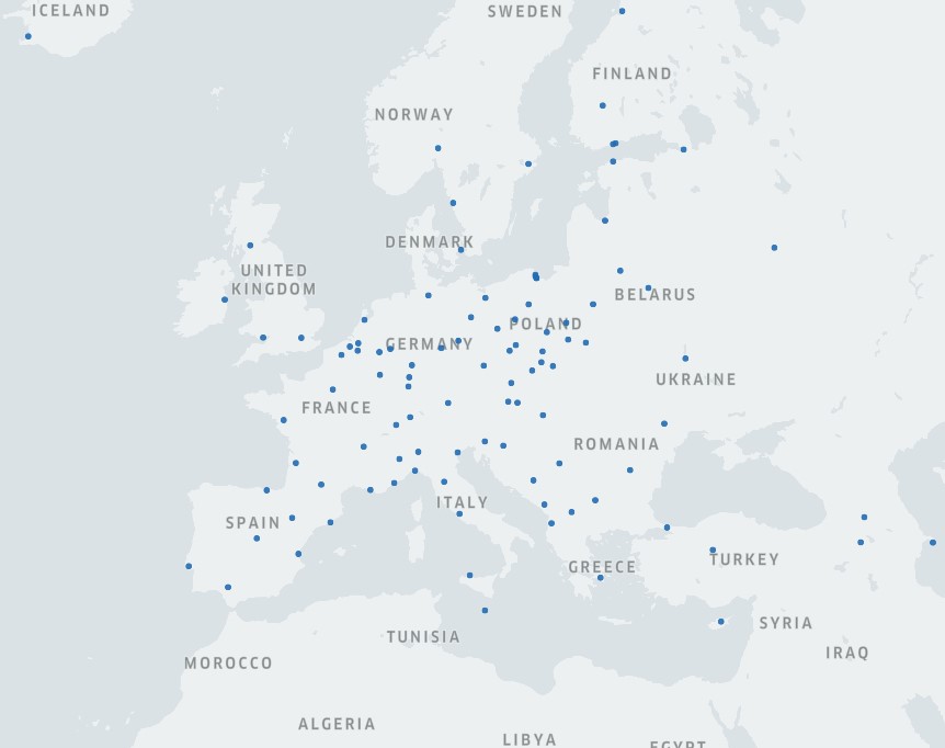
Used Cities
Features
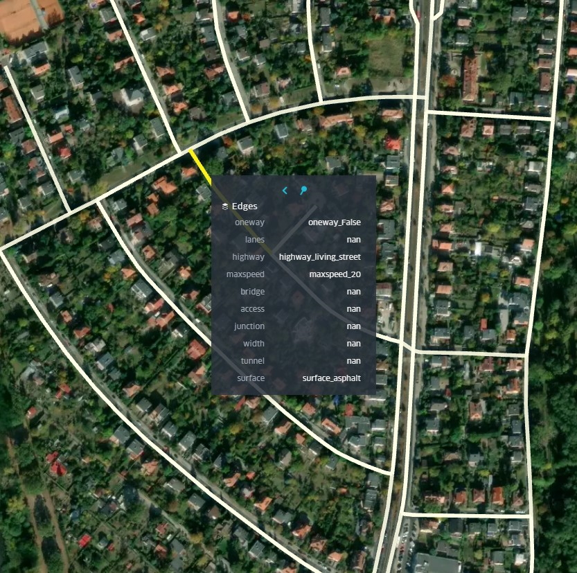
| Tag | Description |
|---|---|
| oneway | whether the road is one-way |
| highway | rank of the road |
| surface | physical surface, structure, composition |
| maxspeed | maximum legal speed limit |
| lanes | number of traffic lanes |
| bridge | type of bridge that the way is on |
| junction | type of junction that the way forms itself |
| access | restrictions on the use |
| tunnel | type of an underground passage |
| width | actual width of a way |
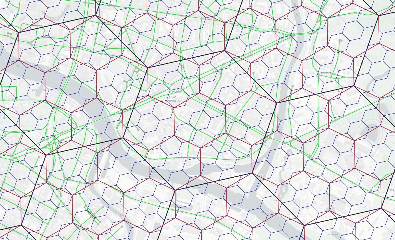
Microregions
Used Uber's H3 (hexagonal hierarchical geospatial indexing system).
highway2vec
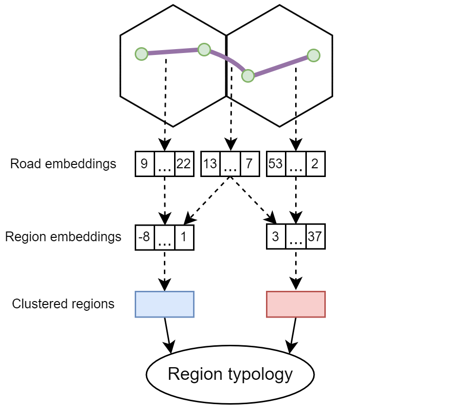
Autoencoder

Aggregation

Results
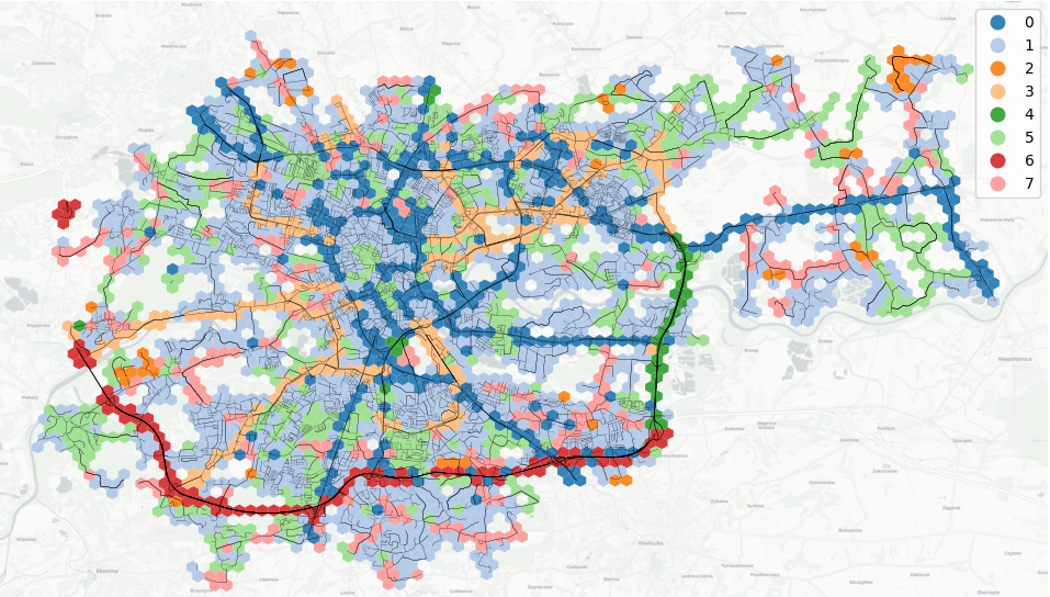
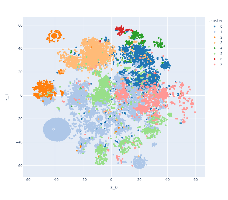
Typology
| Color | Description | |
|---|---|---|
| 0 | blue | high-capacity regions containing arterial roads |
| 1 | light blue | residential, paved regions with good quality of road infrastructure |
| 2 | orange | residential, unpaved regions with low quality of road infrastructure |
| 3 | light orange | regions complementing main road network |
| 4 | green | high-capacity, high-speed regions and bypasses |
| 5 | light green | estate regions and connectors |
| 6 | red | motorways |
| 7 | light red | traffic collectors and connectors |
Microregions
| City | Typology |
|---|---|
| Bydgoszcz | 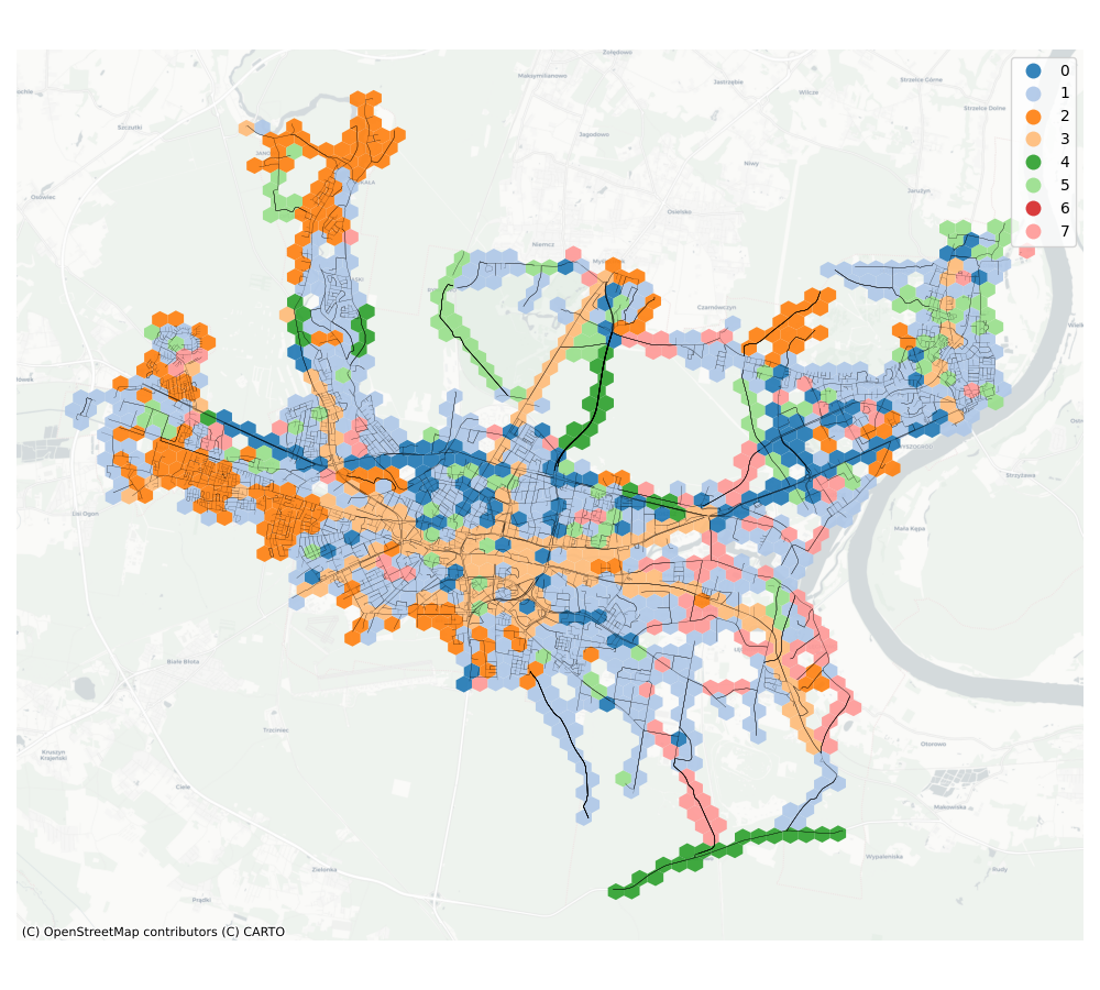 |
| Cracow | |
| Poznan | 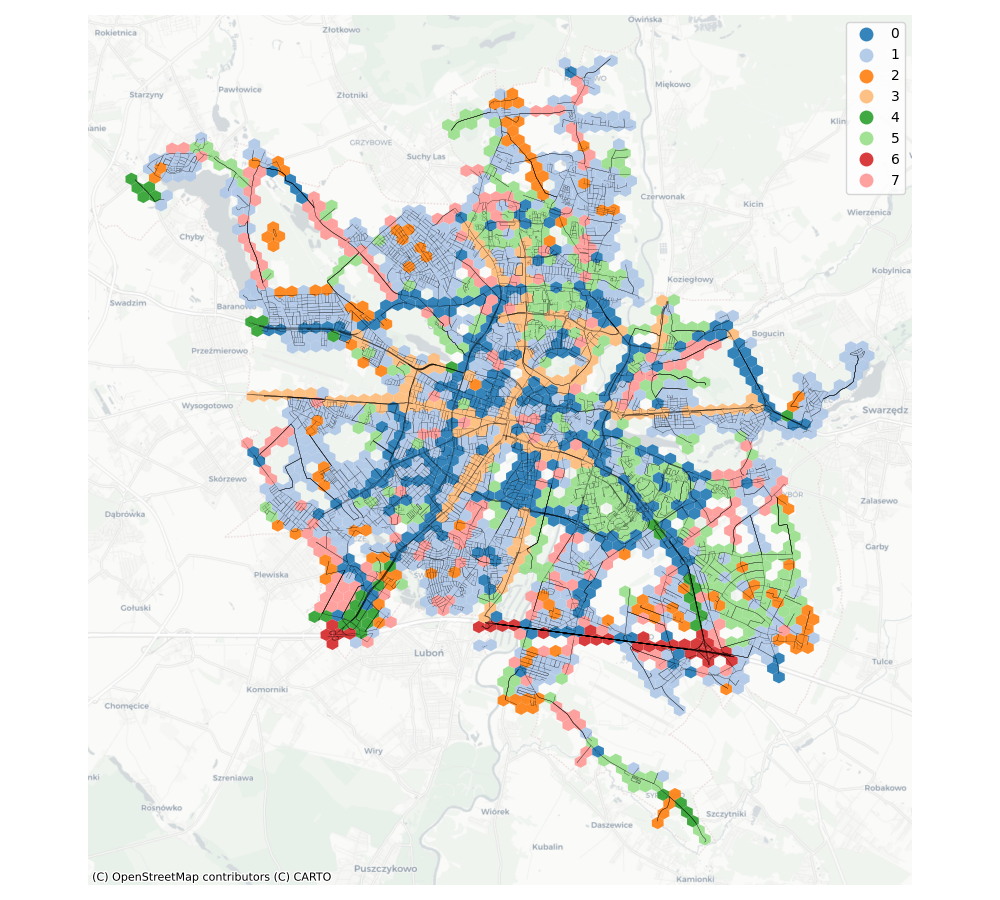 |
| Tricity | 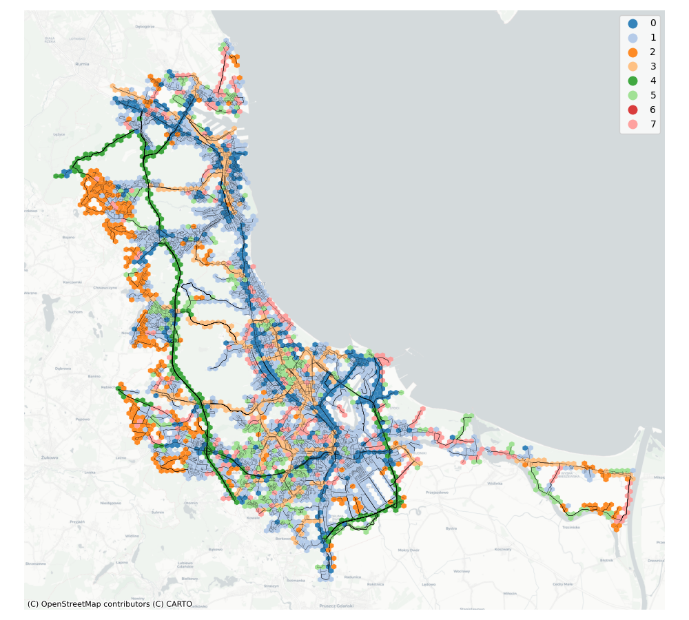 |
| Warsaw | 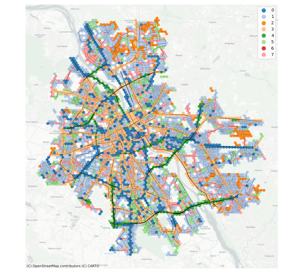 |
| Wroclaw | 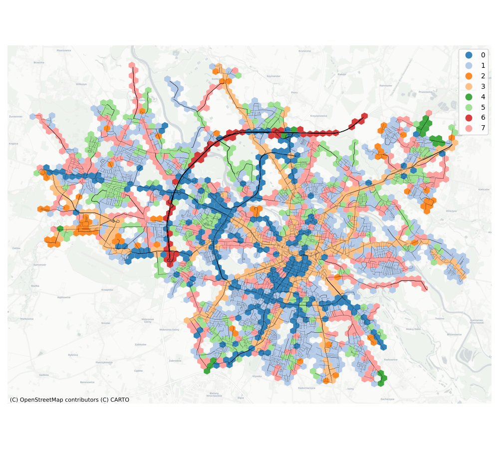 |
Latent Space
t-SNE
| City | Latent space projected into RGB |
|---|---|
| Bydgoszcz | 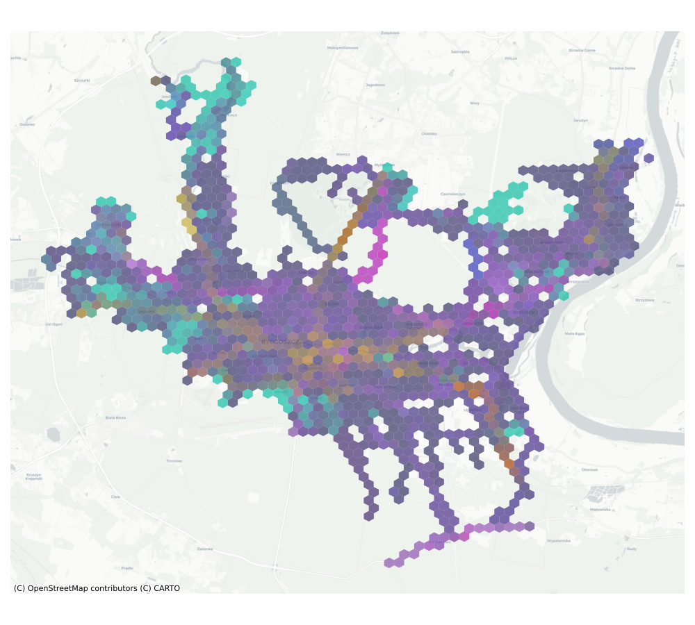 |
| Cracow | 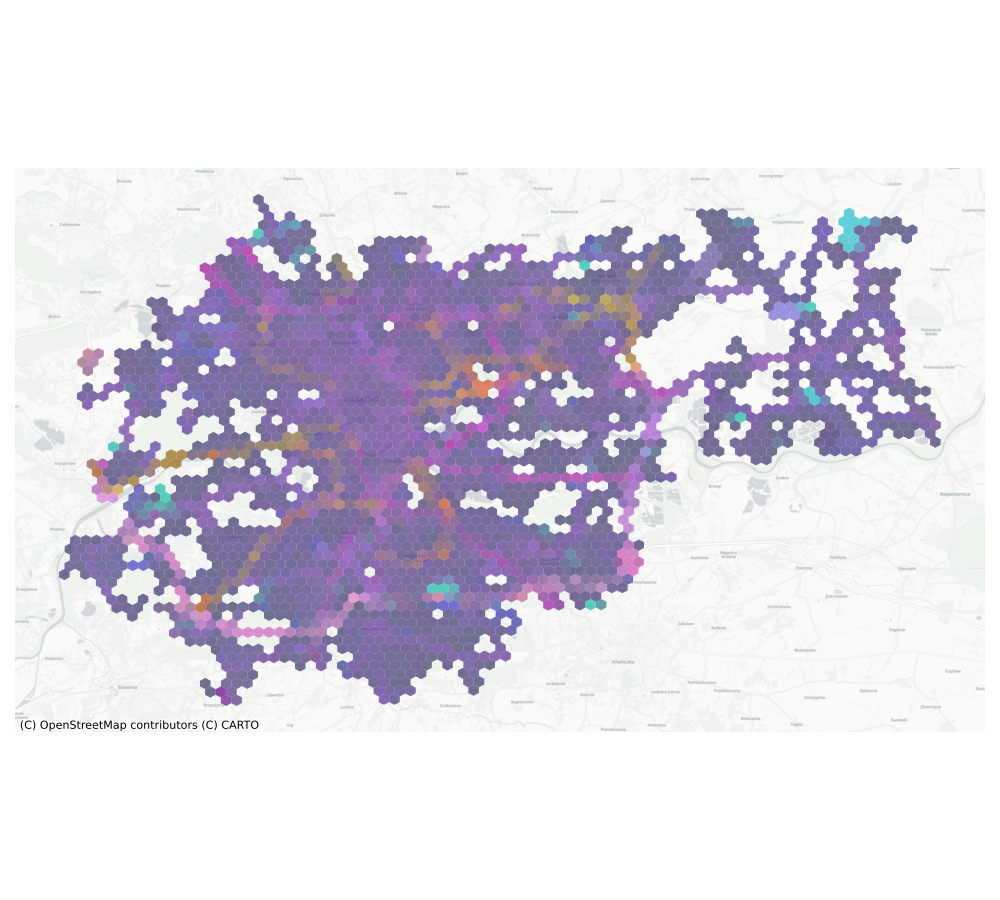 |
| Poznan | 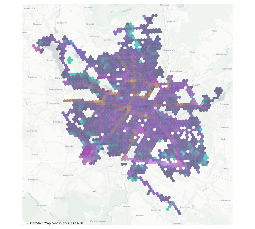 |
| Tricity |  |
| Warsaw | 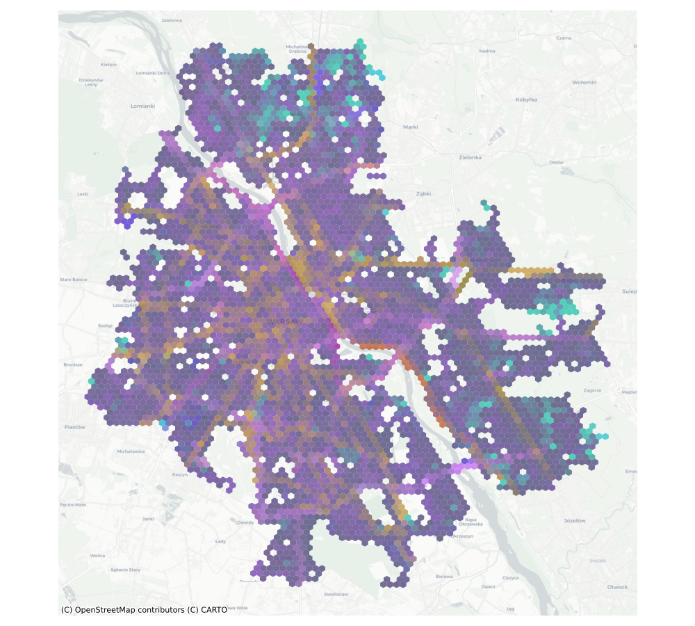 |
| Wroclaw | 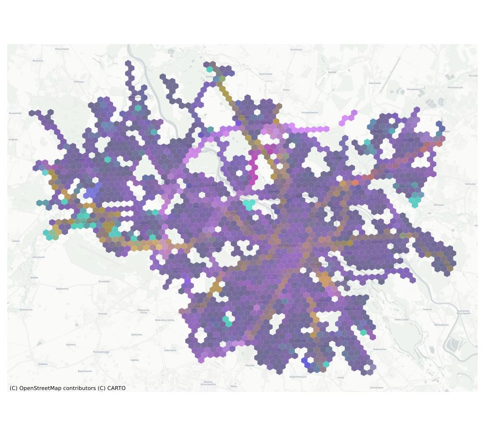 |
Operations in latent space
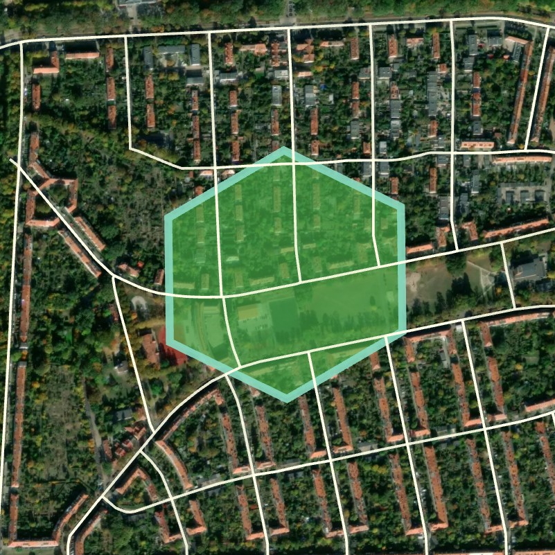
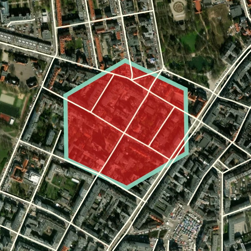
| Summand | Summand | Result |
|---|---|---|
| High-traffic region containing a bridge | Residential region | Residential area next to high-traffic roads |
 |
 |
 |
Appendix
City feature occurance
